
Written by and Photos by Jon Beck. Posted in Rides
Colorado has the highest mean elevation of any of the United States. While Alaska and California may contain the highest and lowest points in the U.S., respectively, Colorado allows the traveler to experience more varied high-altitude environments than any other place in the country.
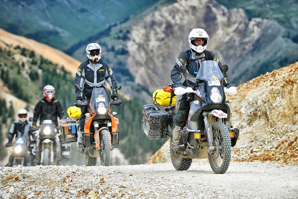
With the highest low point in the U.S., even the valleys in Colorado are high. Hiking, jeep, horse, and bicycle trails permeate the state. But there’s no better way to explore this craggy block of land than aboard a well prepared dual-sport motorcycle. Our group of nine riders set out aboard four KTMs, three BMWs, one Yamaha, and a Kawasaki to scout at least one safe, legal, and pristine route through this state.
As we would come to learn, the pristine aspect was easy to obtain. Turn the key and ghost ride a bike in virtually any direction, and chances are it will find its way to some road or trail lifted from a postcard. We would also be reminded that “safe” was largely determined by a mix of both terrain and whatever pair of hands were gripping the bars.
Each of us involved in this project meandered our way from various points in the western U.S. to Cortez, Colorado, where we would begin the trek. Located in the southwestern corner of the state, Cortez is just a few miles from the Four Corners monument.
The topographic equivalent of seeing a lone man wandering through the vast desert with little more than a bottle of something and a glazed look in his eye, Four Corners makes you wonder why it is there at all. It’s the only location in the United States where four states meet and share a border, but there are no geographical features that would account for this.
The groundwork which led to the existence of this unusual monument was laid by an uncommon act of Congress in 1863. Using the southwest corner of the Colorado Territory as a starting point, Congress created the Arizona Territory. Then, as the territories morphed into states, this particular point remained as a shared border, and a marker was finally placed there in 1912. For our purposes, this was an ideal location to launch the trip.
Southwestern Colorado is part of the Colorado Plateau, which spans portions of Colorado, Utah, Arizona, and New Mexico. This high desert plain is largely arid and the center for a variety of weather systems in the area. It’s also home to several semiautonomous Indian tribes, so finding remote camping can sometimes be difficult. Vistas greeting any rider in this area will share characteristics of the four states which also share the plateau; however, these similarities fade rapidly as the Rocky Mountains approach.
Prior to meeting up with the group, I had two days of riding from California. Originally, the plan was to break up the trip into two relatively easy segments; however, even the best-laid plans can be redirected by the realities of the road. In the case of day one, stunning conditions pulled me from southern California to Flagstaff, where I encountered weather that pushed me farther than originally intended.
Just north of Flagstaff is where the road enters Ute Indian lands, and miles of fenced-in highway. With almost nothing in the way of convenient off-highway camping to be found, I continued northward until four states later the Colorado border passed beneath my wheels.
It was little more than a lucky glance that spotted a potential campsite, from the highway, shortly before dark. Next to a river that first evening, seemingly hedged in on all sides by a storm zeroing in on my location, the sky painted an expansive “welcome to Colorado” sign of white lightning against a backdrop of black clouds.
Following a south-to-north route, the first section would likely seem familiar to anyone who has traveled through Utah or Arizona: High desert mesa, punctuated by massive natural stone monuments. Perhaps the first clue that we were somewhere unique, and headed into unfamiliar terrain, was the weather pattern.
As is often the case at high elevation, capricious weather was the rule rather than the exception. The climate in this part of the country is as stable as Jim Carrey’s facial expressions, so being prepared for anything is crucial.

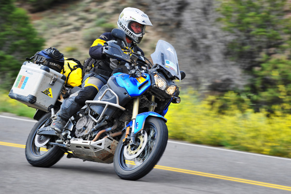
For my part, being decked out in a Gore-Tex KLIM riding suit made things that much more efficient by not having to fuss with liners, or over-jacket rain shells. When rain starts, just close the vents. Tucking in behind the behemoth windscreen of the BMW 1200GS Adventure on the highway sections was also a welcome luxury when the weather turned hostile.
On the subject of the bike, anyone who owns one of these two-wheeled mammoths should not at all hesitate bringing it on a Backcountry Discovery Route like this one. Between the torque profile of a Russian armored train, and luggage capacity sufficient to roam these trails indefinitely, the 1200 Adventure quickly became a friend on the trail. Many extremely steep and tight switchbacks were rendered nearly flat by a first gear lower than Barry White’s voice.
However, Colorado’s mountain passes are not for the faint of heart. Nearly every pass has sections of narrow, rocky road with exposure to massive drops that give even experienced four-wheelers pause. This is backcountry that demands the rider’s full attention.
Pushing farther north, the mountainous terrain begins to take on an array of colors and immense vistas leading to its informal title, “Switzerland of the Americas.” Heading up Ophir Pass, Technicolor mountains towered over our group as we ascended to dizzying heights in an ocean of what seemed like endless landscape.
Descending out of this dreamlike terrain towards pavement and fuel did not necessarily mean a less spectacular experience. Roughly between Ophir and Cinnamon Pass lies the “Million Dollar Highway.” Speculation regarding the origin of this highway’s name ranges from the estimated amount of gold underneath the pavement, to a cost-per-mile during construction. Whatever the case, the sights along this stretch of slab are impossible to put a price on.
It would be easier to choose the brightest bulb from a bank of stadium lights than it would be to choose a highlight or “best” moment of the trek through Colorado. Cinnamon Pass does stand out by virtue of its diversity. Aside from having the same, or even more, brilliant vistas as the dozen or so passes we summited, Cinnamon has an unusual diversity to it. Scenery ranged from a rainbow of treeless alpine tundra, to shadowy forests, to lush meadow, to quaint villages.
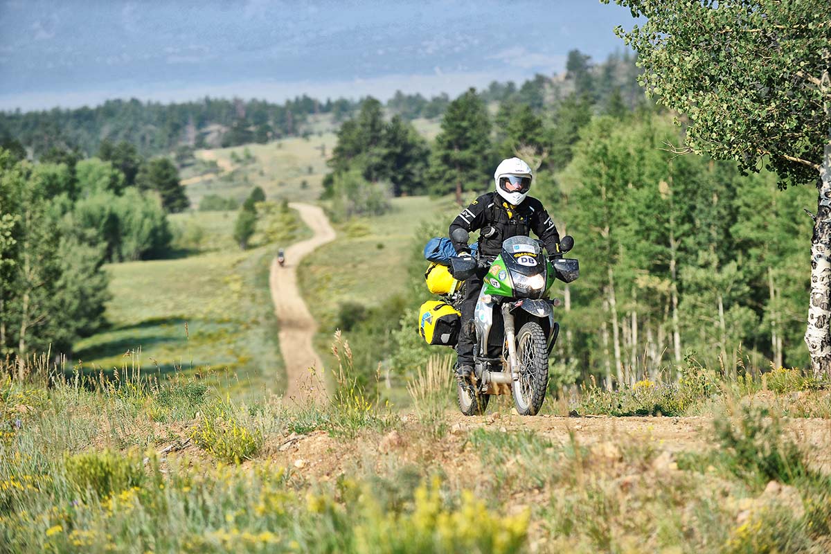
Through it all we followed a route offering up smooth gravel, rocky ascent, technical descents, and dusty back roads. Every switchback was a potential postcard, and we all carefully divided our attention between mental snapshots and keeping the bikes upright on the increasingly challenging roads.
At one point, one of the KTMs zigged when it should have zagged, resulting in an upside-down adventure bike and a broken elbow. Undeterred, the rider rejoined our group after an overnight stay in the hospital, and continued on to the finish. The call of Colorado’s backcountry goes a long way toward muting the discomfort of cracked bones apparently.
Leaving breakfast in Steamboat Springs, we boarded our machines and turned the keys for what would be the final stretch of the Colorado Backcountry Discovery Route. Passes, alpine lakes, and thin air had given way to dense aspen forests and high plains as we progressed north towards Wyoming. Speeds along the unpaved routes began to increase as the roads straightened out, and bottomless drops became rolling hills.
This thorough backdrop change made the trip seem perhaps longer than it actually was. Remembering yesterday was like remembering an entirely separate journey in some other distant place.
Photo opportunities, campsites, and fun riding conditions remained as abundant as ever right up to the route’s conclusion at the Wyoming border. Each day of the BDR was a journey in its own right, and unlike plot points in a film leading to a conclusion, every segment of the Colorado Backcountry Discovery Route could serve as its own conclusion.
Our group parted ways in remote northern Colorado and I headed west towards the Pacific, convinced that I had just experienced arguably the best way possible to explore Colorado’s backcountry.
More information and GPS tracks available at: RideBDR.com